Freshwater Exploration Series: Spring 2019 Event

Dams in the Pacific Northwest

After the fall field trip to the Skagit River Hydroelectric project and the winter Student Roundtable, the Freshwater Exploration Series is moving downstream to the next activity: an expert panel on dam management strategies and future research needs. 

RSVP

What: Freshwater Exploration Series: Spring Panel on Dams in the PNW

When: Wednesday, May 8, 2019, 5:00-7:00 pm

Where: Electrical Engineering Building, Room 303

Details: This event will feature panelists from academia and industry of different backgrounds: engineering, fisheries, and humanities. The event will focus on answering questions curated by students during previous activities related to dam management strategies and future research needs. First, each speaker will give a brief (~10 minute) presentation, addressing questions from their unique professional perspectives. Then, the floor will be open for conversation between the panelists and audience, allowing us to dive deeper into the complexities and nuisances of dam impacts and management.

Panelists:

  • Chris Frans, Civil Engineer/Hydrologist, US Army Corps of Engineers
  • Erin Lowery, Fisheries Biologist, Seattle City Light
  • Margaret H. Redsteer, Assistant Professor, School of Interdisciplinary Arts & Sciences, UW Bothell

RSVP

Contact Claire Beveridge with questions: cbev@uw.edu


Freshwater Initiative, eScience Institute Host First Waterhackweek

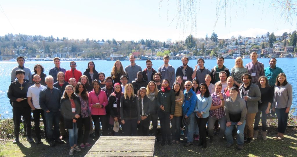
Waterhackweek 2019 participants at Portage Bay
Waterhackweek 2019 participants at Portage Bay (Robin Brooks / UW eScience Institute)

The UW Freshwater Initiative hosted the first Waterhackweek in partnership with the UW eScience Institute March 25 – 29, 2019 at the University of Washington (UW). At Waterhackweek, a five-day collaborative event for freshwater-related data science, water scientists from UW, other US and international universities, industry, and state departments learned about open-source technology, models, and data for conducting state-of-the-art research.

Waterhackweek participants at the opening reception
Waterhackweek participants at the opening reception (Yifan Cheng / UW Freshwater Initiative)

The hackweek model has emerged within the data science community as a powerful tool for fostering exchange of ideas in research and computation by providing training in modern data analysis workflows. In contrast to conventional academic conferences or workshops, hackweeks are intensive and interactive, facilitated by three core components: tutorials on state-of-the-art methodology, peer-learning, and on-site project work in a collaborative environment.This setup is particularly powerful for sciences that require not only domain-specific knowledge, but also effective computational workflows to foster rapid exchange of ideas and make discovery, as has been shown by the success of the previous eScience hackweeks. This is an excellent match with the nature of freshwater research where issues are sizeable and complicated and the community is diverse and synergistic.

Mornings consisted of interactive lectures, while afternoon sessions involved exploration of datasets and hands-on software development through project work in groups of four to eight people. During morning tutorial sessions, participants learned about state-of-the-art data science tools and workflows in interactive lectures covering techniques like accessing and formatting hydrometeorological datasets, leveraging community water data services, visualization, cloud computing, machine learning, Google Earth Engine, and practices for reproducible science.

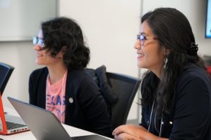
Participants enjoy a Waterhackweek presentation
Participants enjoy a Waterhackweek presentation (Yifan Cheng / UW Freshwater Initiative)

On the first day of the event, interested participants were given the chance to pitch a project idea to the rest of the group. Their peers then decided which project they would like to “hack” on for the rest the week, and joined the project leaders to form project teams. Each afternoon, those small groups worked to define, clarify, and tackle different challenges in water sciences. The selected topics covered a broad spectrum of regions and subject matter, from the arid Southwest U.S. to tropical Hawaii and from Amazonian rivers to Alaskan lakes.

The teams used a diverse array of technologies to approach their chosen problems. One team explored the possibility of using a Raspberry Pi to collect and distribute water quality information during natural disasters. Another group used Google Earth Engine to model the complex dynamics of wildfire, vegetation change, surface water, and carbon release. Yet another team used Python data science and mapping libraries to visualize groundwater contaminants in California, while Conrad Koziol (Inlet Labs) and his team projected the future hydrology of the Pacific Northwest.

Explore the projects on GitHub

As part of the event, Waterhackweek participants, industry professionals, and members of the greater Freshwater Initiative and eScience Institute communities also attended Thursday evening’s Waterhackweek Community Mixer. Special guest speaker Sally Jewell, former U.S. Secretary of the Interior under President Barack Obama and former CEO of REI, discussed her experiences in understanding and managing water resources for the benefit of society. Waterhackweek 2019 participants also described their innovative new research in 90-second lightning talks and networked with experts in the freshwater and data science communities.

Special guest Sally Jewell speaking at the Waterhackweek Community Mixer
Special guest Sally Jewell speaking at the Waterhackweek Community Mixer (Yifan Cheng / UW Freshwater Initiative)

Thanks to our 2019 Waterhackweek organizers, including Nicoleta Cristea, Christina Bandaragoda, Anthony Arendt, Veronica Smith, Lillian McGill, Jacob Deppen, Owen Freed, Madhavi Srinivasan, and Rachael Murray.

The next Waterhackweek will take place March 23 – 27, 2020. Applications will open in August 2019 — stay tuned!


EPA Postdoctoral Research Opportunity

Quantifying the role of surface water storage features in mediating watershed-scale nutrients

We are excited to share a new postdoctoral research opportunity to investigate, characterize, and quantify (via statistical, geospatial, and/or hydrological models) the role of landscape surface water storage features (e.g., wetlands) and their associated hydrological and biogeochemical functions on downstream water quality. This competitive, three-year postdoctoral opportunity is with the US Environmental Protection Agency’s Office of Research and Development in Cincinnati, Ohio.

Application period ends May 2nd, 2019.

Overview

Many of the nation’s waterways remained affected by excess nutrients, which leads to harmful algal blooms, hypoxia, poor ecological condition and drinking-water quality. The focus of this research will be on identifying and characterizing landscape surface water features (e.g., natural, restored, and constructed wetlands and floodplain systems) that remove nutrients prior to reaching downstream surface waters and quantifying how surface water storage contributes to watershed-scale nutrient conditions. The research will be implemented using state-of-the-science combined “big data” (monitored gage-data analysis and synthesis, geospatial and remote-sensing applications) and watershed-modeling approaches (e.g., advanced statistical and/or process-based) to identify prioritized areas within large, regional-scale watersheds with the greatest effect in reducing nutrient runoff to surface-waters. A focus will be on areas vulnerable to harmful algal blooms and used for surface-water supplies and recreational activities.

The preferred candidate will have a Ph.D. in environmental engineering, hydrology, geography, environmental science, or a related discipline. S/he will have experience in (1) watershed hydrology and biogeochemistry; (2) watershed modeling; (3) advanced numerical and/or statistical methods for surface-water and landscape-scale analyses; (4) GIS/remote-sensing software and applications; and (5) scripting (e.g., Python, R) and/or coding (e.g., C++, Java, FORTRAN) language.

The candidate is expected to join our productive and enthusiastic research team of watershed hydrologists, biogeochemists, and systems ecologists this fall for a three-year federal postdoctoral research appointment.

Position specifics

Feel free to reach out with any questions: Dr. Heather Golden (golden.heather@epa.gov) and/or Dr. Charles Lane (lane.charles@epa.gov)


2019 ESIP Summer Meeting

Data in Action: Increasing the Use and Value of Earth Science Data and Information

For 20 years, ESIP meetings have brought together the most innovative thinkers and leaders around Earth observation data, thus forming a community dedicated to making Earth observations more discoverable, accessible and useful to researchers, practitioners, policymakers, and the public.
The week is sure to be filled with a number of exciting plenary talks, breakout sessions, posters, and more.

Dates: Tuesday, July 16th – Friday, July 19th, 2019 (ending after lunch), side meetings on 7/15.
Theme: Data in Action: Increasing the Use and Value of Earth Science Data and Information.
Call for Sessions: PROPOSE A SESSION here by April 26th, 2019.

Meeting Location: Greater Tacoma Convention Center, 1500 Commerce St, Tacoma, WA 98402

Lodging: The official hotel of the meeting is Hotel Murano, located at 1320 Broadway, Tacoma, WA 98402. The group rate is $121 per night. Online and phone reservations will be accepted until June 17, 2019. To make online reservations, click here. You may also make reservations by phone at 253-238-8000 or 877-986-8083 using the code “ESIP SUMMER MEETING BLOCK”.

Meeting Registration
Before the early registration deadline, registration is $415 for ESIP partner affiliates and $550 for non-partner affiliates. After June 28th, registration is $515 for partner affiliates and $650 for non-partner affiliates. The student registration rate is $150. A special one-day rate is available for $200. The teacher registration rate is $50. Teachers attending the Teacher Workshop will be refunded the registration fee after attending the meeting plus a stipend of $200. A full refund will be given for all registration types until June 19th.

REAL ID Act: The REAL ID Act establishes minimum security standards for license issuance and production and prohibits Federal agencies from accepting driver’s licenses and identification cards from states not meeting the Act’s minimum standards. If your state is non-compliant and does not have an extension, you may not be able to board a federally regulated commercial aircraft with just your state-issued driver’s license. Please visit https://www.dhs.gov/real-id prior to travel to find your state status and ensure you have appropriate identification.

Questions: Contact staff@esipfed.org


5th CUAHSI Conference on Hydroinformatics

Hydroinformatics for Scientific Knowledge, Informed Policy, and Effective Response

July 29 – 31, 2019
Brigham Young University, Provo, UT

Details

Join the CUAHSI community this summer to explore the latest innovations in water-data science during July 29 – 31, 2019 on the campus of Brigham Young University in Provo, UT! The 2019 CUAHSI Conference on Hydroinformatics will gather researchers and practitioners to share their most recent approaches, products, and theory for, developing, applying, and maintaining hydroinformatics for valuable scientific and applied outcomes.

The CUAHSI Conference on Hydroinformatics is uniquely focused on data science and technology for water resources and hydrology. This conference will include keynote speakers and oral, poster, and hands-on sessions. Start planning now to be a part of this important meeting.

We are pleased to announce the following Keynote Speakers:

  • Ni-Bin Chang, University of Central Florida
  • Tyler Erickson, Google Earth Engine and Google Earth Outreach
  • Sara Larsen, Western States Water Council Water Data Exchange
  • Gene Shawcroft, Central Utah Water Conservancy District
  • Chaopeng Shen, Pennsylvania State University

Registration Deadlines

Early Bird Registration Deadline: June 15

Regular Registration Deadline: July 15


Machine Learning/Data Science Internship

Mixing technology, data, and first-in-class innovation, EagleView® is not only leading the property data analytics market, but also changing lives along the way. Come join us and make great things happen!

EagleView is a fast-growing technology company driving game changing innovation in multibillion-dollar markets such as property insurance, energy, construction, and government. Leveraging 17 years of the most advanced aerial imaging technology in the world, along with the most recent advances in machine learning and AI, EagleView is fundamentally transforming how our customers do business.

At EagleView, we believe that making our culture engaging and empowering are keys to success. Our kitchens are stocked 24/7; social, athletic, and wellness opportunities are plentiful; and the growth, education, and potential of employees is a top priority, making EagleView a “Best Place to Work” for more than five years running.

Job Description

We are looking for a talented student that’s interested in a Machine Learning, Data Science position. You’ll have the opportunity to work with a fun, hardworking and talented team to help develop and run neural net classifiers for aerial and drone imagery.

PRIMARY RESPONSIBILITIES

  • Help to aggregate, clean, and organize training data for machine learning
  • Help evaluate and document model performance
  • Work with other members of the Machine Learning Team to scale the use of neural networks for imagery classification and other applications
  • Research and experiment new technologies that can improve algorithm applications

Skills & Requirements

  • Experience with Python or similar language
  • Experience Amazon AWS or other cloud compute services
  • Working knowledge of Linux-based command line environments
  • Working toward a Bachelor’s Degree, preferably in science, data science, engineering, computer science, or related field

Apply Online